
Yes, it really says 19.4 km (just over 12 miles)., ascending 765m (2,510') and descaending 1,126m (3,700'). In about 1/2 hour, there was a patch of blue sky, but was still pretty foggy looking back to where we had come from.


A couple of hours later the clouds gave way, and we could see where we were and where we were going.

Maybe it would have been better to not see ahead.
We skirted Mt. Tongariro and at about 10am walked (or blew) by the "Red Crater". My wind guage read 62 kph and 8 degress C.


Looking back on Mt. Tongariro and the "Red Crater".

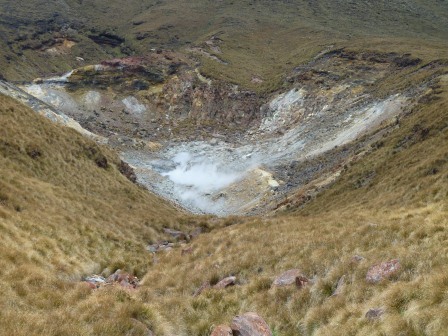
A thermal lake.

Some thermal springs (6 hours into the trip).
We finished in about 8 hours (because Cindy was very slow going downhill) and were very happy to get to our cute cottage.

The next morning on our way out, we drove to the start of the hike to see what it really looked like. Yikes!


No comments:
Post a Comment